Branching out with GiGL
Greenspace Information for Greater London CIC (GiGL) is the capital’s environmental records centre. They collate, manage and make available detailed information on London’s natural environment via a range of services. By working with a variety of stakeholders they provide impartial evidence to enable informed discussion and decision-making in policy and practice. GiGL staff, affectionately known as GiGLers, have written a post to provide a brief overview of what GiGL has done and is doing for trees and woodlands in London, and how you too can help them contribute to the conservation of London’s urban forest.
What does GiGL do to help London’s urban forest?
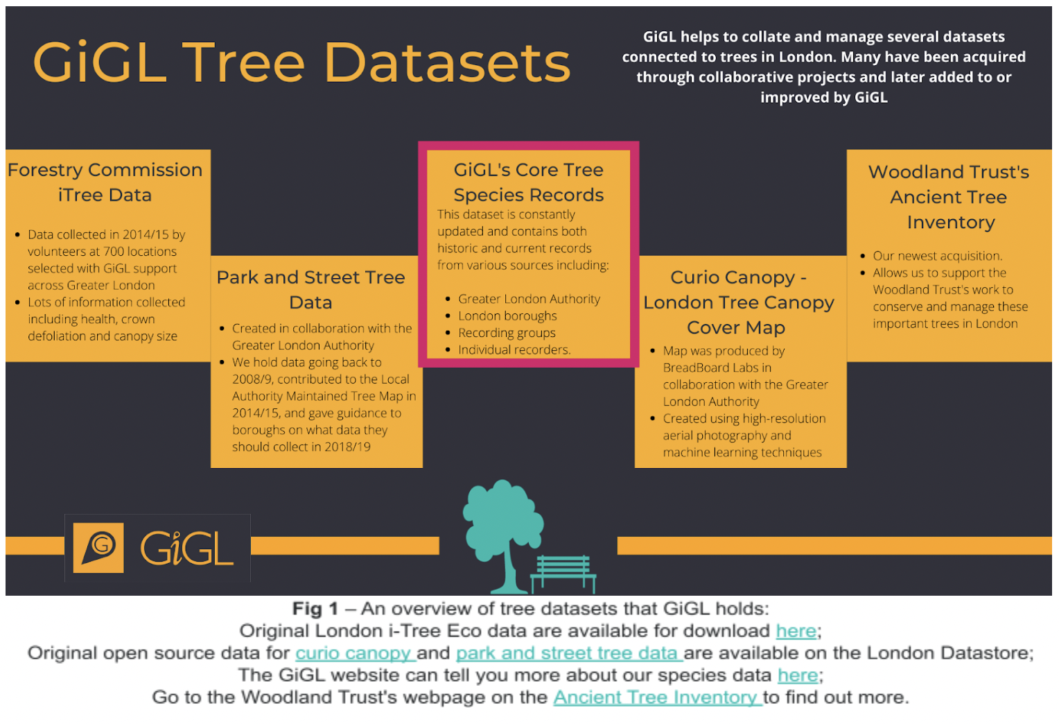
To manage, conserve, and expand London’s urban forest we need to have an accurate understanding of where London’s trees and woodlands are. This is why GiGL holds, maintains, and makes accessible several datasets connected to trees and woodland in London (Fig. 1). These datasets are used by GiGL and a range of GiGL stakeholders to guide biodiversity decision-making and influence the planning-policy process.
GiGL has worked on numerous projects to gather, share, and analyse data on London’s trees. Standout projects include working with the Greater London Authority (GLA) to collate and contribute data for The London Street Tree Map. This map can be used to discover tree species information for over 880,000 georeferenced trees in the capital. In 2018, we also made the Greater London Habitat Survey tree dataset, and all of the 94,840 verified tree records it contains, publicly available via the National Biodiversity Network (NBN) atlas. So next time you are on a walk and pass an interesting tree, why not have a look at these resources, you never know what you might be able to learn.
GiGL also holds data on species that may be threatening the resilience of London’s urban forest. For example, we host the London Invasive Species Initiative, and flag all species records that are considered ‘Species of Concern’. This means that we can track the spread of invasive non-native species such as the oak processionary moth (Thaumetopea processionea), and this information can be used to guide their management.
Most recently, GiGL has helped the Forestry Commission identify priority locations for woodland creation in Greater London’s Green Belt and Metropolitan Open Land (Fig. 2). We are also leading on an exciting project in collaboration with Natural England and the Woodland Trust to update the Ancient Woodland Inventory for Greater London. This project will help to ensure that we have a more accurate understanding of where this irreplaceable habitat is within London, helping to guarantee that sites receive the proper protection and management that they deserve (find out more about the project here).
How can you help?
GiGL datasets are continuously updated and improved, so the outputs that GiGL delivers are defined by the data which we have access to. A lot of our information on species in London comes from members of the public who record what they see. Trees are an obvious sight in the landscape but they are often omitted from recording efforts for that same reason – the assumption is that they must have been recorded already. However the London i-Tree report estimated that there are over eight million trees in London, from street trees to trees in parks, woodlands and private gardens. In contrast, GiGL’s total species dataset is ‘only’ 6 million records so there are a lot of trees still to be counted!
GiGL would love to receive more tree records from members of the public. Though it can seem intimidating at first there are many fantastic resources out there to help with recording. The Woodland Trust has an A-Z of British trees and the Field Studies Council has a fantastic range of courses too. GiGL have an Excel recording spreadsheet which you can use to capture tree records, alternatively use our online form. We ask that recorders provide at a minimum, information on what (species), where, when and who (recorder name). Please do feel free to submit additional details, for example on a tree’s girth (diameter at breast height); height; spread of canopy; age (if known) and condition as these can all add to the wealth of knowledge that trees can provide on an area.
GiGL is also interested in gaining volunteer assistance to help with various projects and tasks and will be working over the next few months to expand the opportunities available for volunteers. Roles may include helping with data entry and maintaining our datasets. We will also be recruiting volunteers to support the Ancient Woodland Inventory Update project, so keep an eye on our volunteer opportunities page.
Please do subscribe to our newsletter the GiGLer to find out more about what we do and don’t hesitate to contact us if you have any questions.


